Ordnance Survey Name Book 1855-57
Ordnance Survey name books provide information about place names and building names on the first edition Ordnance Survey mapping which took
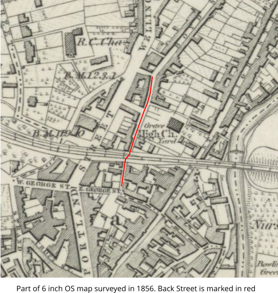
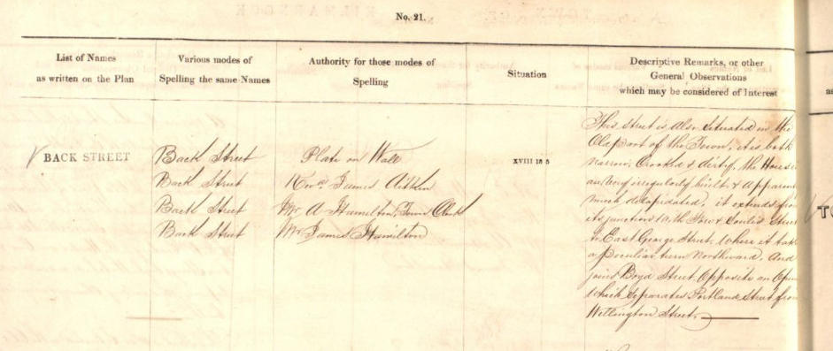
place in the mid-19th century. This is an image of the entry for Back Street, Kilmarnock.
Transcription of last column :
This Street is Also Situated in the Old Part of the Town, it is both narrow, Crooked & dirty. The Houses are very irregularly built, and Apparently much
dilapidated, it extends from its junction with Fore & Soulis Streets to East George Street, where it takes a peculiar turn northward, and joins Boyd Street,
Opposite an Opening which Separated Portland Street from Wellington Street.